I just added a map to the site. It shows where Samantha, Marcus, and Vlad go in Zero Knowledge, chapter by chapter.
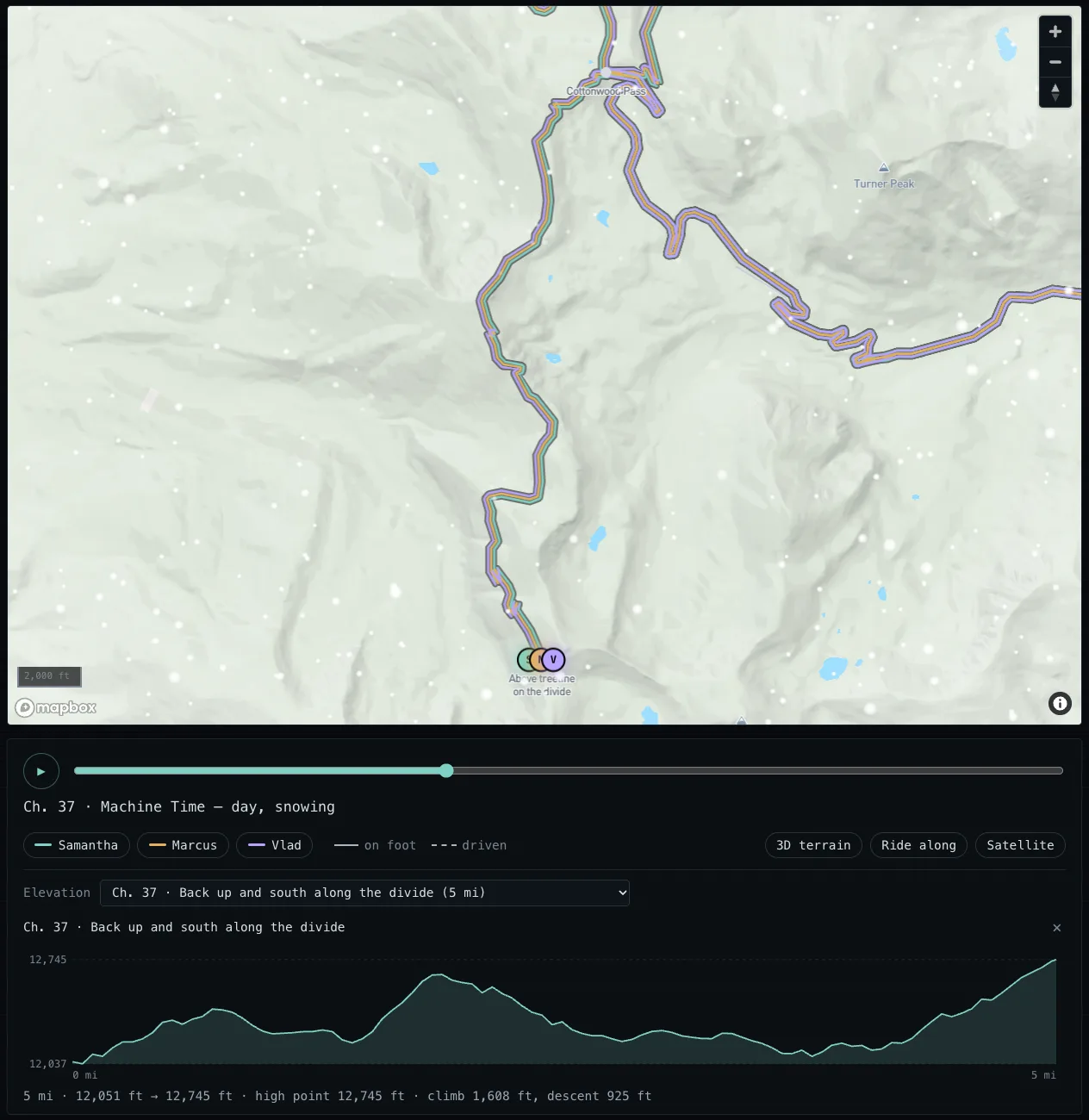
Chapter 37, and the elevation profile of that day’s walk along the divide. Map © Mapbox, © OpenStreetMap contributors.
Almost every place in the book is real. Drag the slider to a chapter and you’ll see each of them as a colored line, the places they stopped, and where each of them is as of that chapter. Click a place and it tells you what happened there and in which chapters. Press Play and it moves through the book one chapter at a time.
If you turn on Ride along and press Play, the camera follows each chapter’s route over the mountains in 3D. Every stretch they walk has an elevation profile with the climb, the descent, and the high point - Hope Pass in chapter 23 tops out at 12,548 feet. The map is lit for how each chapter ends (dawn, day, dusk, or night), and it snows when it snows in the book. There’s also a satellite view.
Here’s how I built it (well, how Phin built it with my help). The whole process took less than an hour.
Every chapter in the manuscript starts with a header that says where and when it takes place. Phin read those headers and turned them into a list of every leg of the trip: who went, from where to where, and whether they walked, drove, or took a bus or train. Then it traced each leg onto real trails and roads from OpenStreetMap, so when they hike the Colorado Trail, the line follows the Colorado Trail instead of cutting straight across the mountains. The three invented places are marked as invented, and the places the book is vague about get an approximate pin.
I used Mapbox for the map. The elevation profiles had a constraint I didn’t expect. Mapbox’s terms don’t allow you to save data you pull out of their maps, so the site can’t calculate the profiles once and store them. Instead, when you pick a walk, the page measures it from the map’s own terrain right there in your browser, every few hundred feet along the route, and throws the numbers away when you leave. It takes about a second.
For the lighting, Phin had five separate AI readers go through the manuscript at the same time. Each one recorded how its chapters end - the time of day and the weather - along with the sentence that settled it. That became the dawn, day, dusk, and night you see as you move the slider, plus the snow.
Before anything ships, three AI reviewers (two Claude, one from OpenAI) read the code, and Phin fixes what they find. This time one of them asked whether the falling snow would keep the map from ever finishing loading. Phin tested it, and it did. Without the fix, the elevation profile for any walk in a snowy chapter would have said “Measuring the climb…” forever.
Go play with it. Turn on Ride along, press Play, and follow them over Hope Pass.